


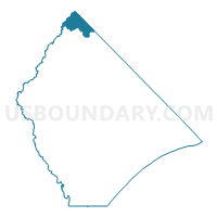
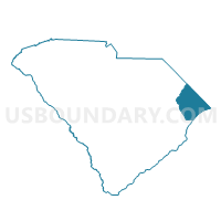
Spring Branch Voting District, Horry County, South Carolina
About
Outline

Summary
| Unique Area Identifier | 666067 |
| Name | Spring Branch Voting District |
| County | Horry County |
| State | South Carolina |
| Area (square miles) | 23.07 |
| Land Area (square miles) | 23.03 |
| Water Area (square miles) | 0.04 |
| % of Land Area | 99.85 |
| % of Water Area | 0.15 |
| Latitude of the Internal Point | 34.25473660 |
| Longtitude of the Internal Point | -79.05154680 |
Maps

Graphs
Select a template below for downloading or customizing gragh for Spring Branch Voting District, Horry County, South Carolina


Neighbors
Neighoring Voting District (by Name) Neighboring Voting District on the Map
- Voting District 37, Robeson County, NC
- Floyds Voting District, Horry County, SC
- Lake View Voting District, Dillon County, SC
- Nichols Voting District, Marion County, SC
- Norton Voting District, Horry County, SC
- Voting District P08, Columbus County, NC
- Voting District P09, Columbus County, NC
Top 10 Neighboring County Subdivision (by Population) Neighboring County Subdivision on the Map
- Mullins CCD, Marion County, SC (11,861)
- Lake View CCD, Dillon County, SC (4,370)
- Floyds Crossroads CCD, Horry County, SC (3,301)
- Fair Bluff township, Columbus County, NC (1,788)
- Sterlings township, Robeson County, NC (959)
Top 10 Neighboring Unified School District (by Population) Neighboring Unified School District on the Map
- Horry County School District, SC (269,291)
- Robeson County Schools, NC (134,168)
- Columbus County Schools, NC (43,225)
- Marion School District 2, SC (11,648)
- Dillon School District 1, SC (5,462)
Top 10 Neighboring State Legislative District Lower Chamber (by Population) Neighboring State Legislative District Lower Chamber on the Map
- State House District 20, NC (70,972)
- State House District 48, NC (66,444)
- State House District 55, SC (34,048)
- State House District 57, SC (30,096)
Top 10 Neighboring State Legislative District Upper Chamber (by Population) Neighboring State Legislative District Upper Chamber on the Map
- State Senate District 8, NC (217,746)
- State Senate District 13, NC (181,120)
- State Senate District 28, SC (97,383)
Top 10 Neighboring 111th Congressional District (by Population) Neighboring 111th Congressional District on the Map
- Congressional District 1, SC (856,956)
- Congressional District 5, SC (767,773)
- Congressional District 7, NC (742,938)
- Congressional District 6, SC (682,410)
Top 10 Neighboring Census Tract (by Population) Neighboring Census Tract on the Map
- Census Tract 9705, Dillon County, SC (4,370)
- Census Tract 9306, Columbus County, NC (3,878)
- Census Tract 9504, Marion County, SC (3,863)
- Census Tract 9616.02, Robeson County, NC (3,811)
- Census Tract 101, Horry County, SC (3,301)